
Another day, another scenic drive on New Zealand’s South Island. According to multiple sources on the interwebz (that’s what happens when you hang out with teens 24/7 for more than a week), a non-stop journey along the 235 km of (mostly) one-lane-in-each-direction highway between Franz Josef and Arthur’s Pass should take about three hours.

We adopted our youngest son’s outlook for the day – life’s about the journey, not the destination – so more than 8 hours elapsed between when we closed the hatch on our back of our rental vehicle and when we finally reached our home-away-from-home for the next couple of nights. A couple of off the beaten track side trips, an interesting lunch and a bit of souvenir shopping account for the time difference.
It was almost 11 o’clock when we finally reached the end of a long and increasingly narrow side road that ended at the trailhead parking lot for the Harihari Coastal Walkway. It was just about high tide, so we couldn’t walk the full loop, which includes a couple of stretches along the beach. Instead, we set out along the track through the forest, popping out a few times to take photos of Mt Oneone and stopping once to find a geocache.


We eventually made it all the way to the beach, where the incoming waves and dramatic skies made great subject matter for photography. Mr. GeoK was so caught up taking photographs that he was drenched by a big wave! His pants were soaked and his boots went squish, squish, squish all the way back to the parking lot.


 Fortunately, it was only a short drive until we reached Hokitika. It was well past the lunch time rush when we arrived at Fat Pipi Pizzas shack, so we had the whole place to ourselves, all the better to enjoy the unique character of the place. We opted to eat out back at one of the large tables. Our boys pitched in to help set our table and once Mr. GeoK got over his surprise at being denied ice because “the pop’s already cold”, he had just enough time to rinse out his boots and change into sandals before our very excellent pizzas were ready for eating.
 When we couldn’t eat another bite, we headed out the back gate, down to the beach and then up an alleyway and into town. There are some cute buildings and a little clock tower on the main street, but we spent most of our time at the Hokitika Glass Studio, which produces most of the blown glass souvenirs sold throughout New Zealand. After much deliberation, K chose a Kiwi bird and C selected a beautiful swirl Koru; they took turns hauling their carefully packaged keepsakes around for the rest of our trip.
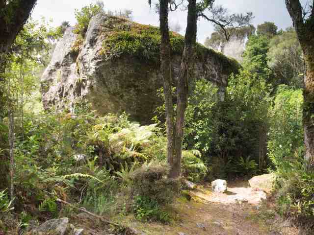
A short distance from Hokitika we turned onto the Otira highway, heading inland to Arthur’s Pass, but we didn’t get very far down the road before spotting the turn-off for Londonderry Rock. The boys opted to stay in the otherwise empty parking lot, so Mr. GeoK and I went off on our own for a short geocaching adventure.

 In 1999, a long viaduct was replaced a very hazardous stretch of the Otira highway. Even so, we found this part of the drive to be fairly challenging, especially the one-lane bridges, so we really appreciated the opportunity to relax for the next couple of days (except for a couple of hours of awesome adventure, so stay tuned). It was almost like stepping back in time, since we had to dress for dinner and the lodge manager presided over pre-dinner drinks in the huge sitting room. We tried some night photography and enjoyed a tour of the farm the next morning. I didn’t know that sheep like to eat stale pastries. Did you?
