
Bad weather forced us to abandon plans for kayaking Lower Kananaskis Lake last year. Mother Nature cooperated this year, with really good conditions for our first paddle around the manmade reservoir just downstream of Upper Kananaskis Lake.
Despite waiting ’til early July for this outing, the water level seemed quite low. Late, high-altitude snowpack and a delayed melt had south/central Alberta’s reservoir operators optimizing June/July water levels for the possibility of a fast melt. No one wants a repeat of the June 2013 flood!
The low water level brought an added level of photographic interest to this trip – a fairly extensive mud-flat “island” between Lower Kananaskis Campground and the private residences along Lake Shore Drive. We’d aim for the same opportunity on any return trip, so that probably means the first half of June most years.
NOTE: I’ve tried to find an online source for checking reservoir water levels before heading out. All the data sets I’ve found abruptly end with 2017. If you know where to find current information on Alberta water body levels, please leave a comment with the link. TIA!
Getting There
We drove Highway 40 south into Kananaskis Country, turning onto Highway 742 at the winter gates in Peter Lougheed Provincial Park. Just a couple of minutes along, we spotted the sign marking the turn to the Canyon Creek Day Use area and boat launch.
We arrived about 8:45 and our timing was fortunate. One power boat launched a few minutes earlier, but we had the boat launch to ourselves for the 15 minutes we need to inflate and launch our Gumotex Thaya tandem kayak.

Note the kayaks on the rack, available for rent; several minutes of internet searching surfaced a rental brochure circa 2016, leading me to think they’re available from Boulton Creek Rentals. I called the number today and they’re closed for the season, reopening in June.
We were maybe the fifth vehicle in the parking lot. And we appreciated the pit toilet facilities after the hour-long drive to the boat launch.
Heading Out (Counterclockwise)
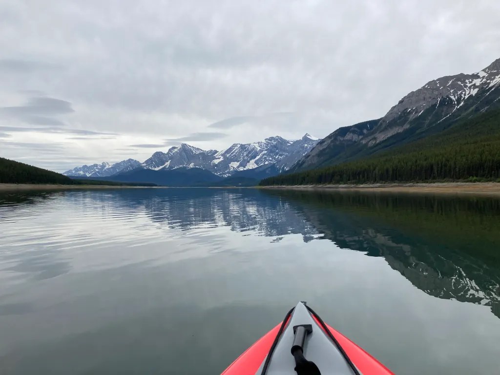
The water source for Canadian Rocky Mountain lakes is a combination of snow melt, glacier melt and sometimes underground springs (fed by karsts, which are charged by rain and snow/glacier melt). So they are always dangerously cold if you go in. In addition to selecting a very stable inflatable kayak and wearing PFDs, we further mitigate risk by sticking close to the shoreline.
The only decision = clockwise or counterclockwise? The key variable in the decision is the sun. Which direction will minimize the amount of photography where we’re shooting into the sun? For our first paddle around Lower Kananaskis Lake, this wasn’t a factor because of extensive cloud cover. And looking at a topo map of the area, given that Lower Kananaskis Lake is so long and narrow, sun angles will always be a problem (or not). So we stuck with our no rationale tradition of paddling counterclockwise.
Peninsula Day Use Area
We did not stop at the Peninsula Day Use Area, but we paddled into the little inlet west of the peninsula. I include this because it was a great place to observe the lowered water level, as shown by the spruce pollen water level markings on the rock wall of the inlet. We estimated the water level to be at least a half meter lower than at its high level earlier during spruce pollen “season.”

Gypsum Creek Area Shoreline
We had no idea what to expect in terms of birdspotting on this lake. But based on our Upper Kananaskis Lake experience, we figured not much variety. First up? A gaggle of Canada Geese along the shoreline near the Gypsum Creek outflow into the lake. Some geese were in the water. Others walked along the shoreline keeping pace with our slow-moving kayak.


We nudged onto the shoreline a little beyond the Gypsum Creek outlet. Mr GeoK stayed aboard while I walked a short distance up from the “beach” to nab a photograph. The extended gravel “beach” is another good indication of the lower-than-usual water level.

Paddling South Towards Interlakes
Mr GeoK kept watching for birds as we (I?) paddled south towards Interlakes. His only other success? A sandpiper along the rocky shoreline.


But the scenery was beautifully reflected in the mirrorlike surface of the lake, including Mt Indefatigable off the starboard (righthand) side of the kayak.


Off the port side, we enjoyed views of the Opal Range, including Mount Wintour and Gap Mountain. And we spotted a couple of early morning kayakers coming off the shore of private residences along Lake Shore Dr.


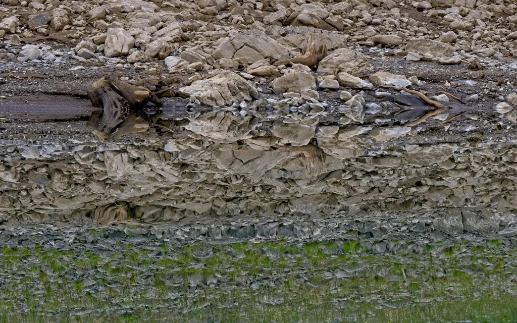
Reflections
Realistic reflections double the impact of mountain scenery. But abstracted reflections are also fun. Ripples automatically create abstraction. Careful framing can also be used.


Interlakes Generating Station
The TransAlta Interlakes hydro generating station is very small – just 5 mega watts. And from what I’ve been able to find, it runs mostly in the winter. My guess is for peak load heating demand.
Anyhow, as we approached, I remembered we’d driven to this Panorama parking area once, when our kids were pretty young. We hung out along the shoreline, just relaxing and we spotted a bear swimming across the lake.

Nothing so exciting this time around. But we were pretty excited when we spotted the pit toilet up at the parking lot! So, second time pulling up to the shoreline for this trip. We took turns holding the kayak in place and using the facility.

As we pushed off from shore, we spotted a group of six kayakers departing from Interlakes. We weren’t feeling chatty, so rather than continue to the end of the lake before turning back, we across and northward, beginning the return leg of our journey.

Lunch Break
Thanks to the low water level, there was a fairly extensive “mud flat” between the Lower Lake and Elkwood campgrounds. We landed on this temporary island for lunch and were greeted by a Killdeer Plover.

Before digging into the lunch bag, I waded out to take a panorama of our picnic site.


After lunch, we wandered for about half an hour, framing reflections of mountain peaks in temporary ponds ringed with spruce pollen.


I liked the serene combination of our kayak pulled up on the beach, some geese paddling by and cyclists pedaling along the lakeshore.

Another few kayaks approached from the north, so we decided it was time to push off from shore and paddle back to the boat launch.

Final Return Stretch
We reached our top paddling speed of 7 kph on the return leg. And we paused only a few times for photographs, including this one of a stand-up paddle boarder enjoying the calm water.

We spotted more kayaks, a couple of canoes and another SUP around the Elk Lake Campground and William Watson Lodge.
From this shot, you can see that we were sitting too low to have line of sight to the Lower Lake Trail.

Approaching the boat launch (on the right end of the yellow boom in the photo below), we could see that it was in use. So we ended up carrying our kayak up to the parking lot to deflate, wipe down and pack up. We pack along a tarp for just this kind of situation. With twelve or fifteen vehicles in the parking lot, we had to spread our tarp several stalls away from our vehicle.

Summary
Total paddling distance: 15.4 km
Total time: 4 hrs 45 minutes including 1 hr 30 for lunch/photography stops
Based on the number of kayaks, canoes and SUPs we saw out paddling, this is a popular water sports destination. In our view, it’s a little less scenic than Upper Kananaskis Lake, mainly because the lake is so long and narrow that you don’t get quite the same perspective on the mountains. And with easy access from Lower Lake and Kananaskis Interlakes campgrounds and a few private properties along the eastern shore of the lake, plus the boat launch, there are more points of access compared to Upper Kananaskis Lake. All of which explains why we saw so many more watercraft on this lake compared to our three outings (to-date) on Upper Kananaskis Lake.
The highlight for us was our lunch stop at the temporary mudflat. We’d aim for similar conditions any time we are kayaking Lower Kananaskis Lake.
Post Script – Two Wildlife Sightings
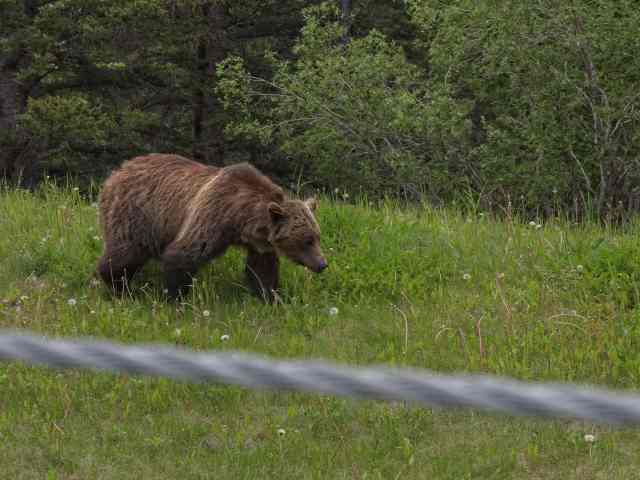
Grizzly Bear
Heading back up Highway 40 towards the TransCanada, we spotted a bunch of vehicles stopped along the road ahead of us. That’s almost always an indicator of wildlife…

…in this case a tagged grizzly bear. We stopped just long enough to snap a couple of photos with our longest telephoto lens. Then we continued on, not wanting to add to the congestion.
Rocky Mountain Bighorn Sheep
The next encounter, close to the Barrier Lake Day Use Area, we had no choice but to stop. A herd of Rocky Mountain Bighorn Sheep was blocking/crossing the Highway. I got a chuckle out of the RAM vs ram dynamic. 🙂


My wife and I have kayaked Kananaskis Lake in the past in our sea kayaks. PLEASE! be prepared for cold water paddling. Spectacular Lake, BUT, safety first!
Pingback: Explore - Out & About with the GeoKs