
We hiked in the Canadian Rockies for over 20 years before finally making the trek to Aylmer Pass. Why? Three reasons. First, it’s really close to Banff, and other trails close to Banff haven’t been that impressive. Second, trail restrictions require a tight group of four hikers for most of the season. Finally, it’s dauntingly long (30+ km). We opted for Aylmer Pass as our last hike of the 2020 season. We worked hard all summer to be sure our legs would carry us (and our packs) the distance. And while it wasn’t a case of saving the best for last, we plan to do it again – but will bike the front end Lake Minnewanka Trail.
It’s worth sharing a few more details about the seasonal restrictions that apply to this trail. These rules apply cyclists, hikers, campers and dog owners and are in effect for most of the summer hiking season to reduce the risk of grizzly/human encounters. Parks Canada can levy a fine of up to $25,000 if they catch you ignoring the restrictions.
Getting There
Trailhead parking is at Lake Minnewanka. Take the easternmost exit to Banff along the TransCanada highway. But don’t head into Banff! Instead, aim north via Lake Minnewanka Drive. Parking is as for the public boat launch and Lake Minnewanka boat tours. There are flush toilets here – a rarity among trailheads!
Lake Minnewanka Drive is a loop for part of the year. From November 15 to April 15, the western section is closed for the benefit of wildlife. For these 5 months, the drive to Lake Minnewanka is via the slighty longer east section, which goes past the turn-off to Johnson Lake and the Two Jack Lake day use area.
The Bow Valley ROAM bus system services Lake Minnewanka. This option was not available during 2020 due to COVID-19.
Trip Report
Parking to Aylmer Pass Trail Junction
By mid-October, there’s only about 11 hours between sunrise and sunset. And facing 30+ km of trail, we decided to start before sunrise and bring headlamps.
It was blue hour when we pulled into the parking lot and set off along the shoreline trail towards Stewart Canyon.

Low cloud/mist hung in the valley. And when I spotted a floating dock, it took me right back to a foggy morning at Bay of Many Coves, in New Zealand.

Because we knew it was 7.8 km to the Aylmer Pass trail junction, we did our best to keep moving at a steady clip. But we ended up pausing several times. First it was to photography the stunning sunglow on Lake Minnewanka.

Then we heard a downy woodpecker and stopped to watch it for several minutes. Next, Mr. GeoK spotted a small herd of mule deer that moved off the trail and into the woods as we approached. Finally, the sun rose high enough that the fall-coloured aspen leaves caught our attention.

The closer we got to the trail junction, the more signs of autumn we noticed.

A double-beam, single railing bridge came as a surprise, just before Aylmer Pass trail junction. Fortunately it’s over a flood drainage channel and there’s not much of a drop off, so my fear of heights was not overly excited!

We covered what turned out to be 8.5 km from the parking lot to the trail junction in 2.5 hours, including about 30 minutes for various photo stops along the way.
Over the next 20 minutes we covered less than 500 meters! Since the fall colour on the aspen trees was so amazing, we took lots of photographs here.


Aylmer Pass Trail
Finally we agreed we needed to get moving again. And we covered the next 2 km – to the Aylmer Lookout trail junction – in 40 minutes. It’s a decent speed, considering the 18% elevation grade! While it was tempting to detour to the old lookout site (like we did on the Sunset trails) we knew we had to carry on.
We continued hiking through the forest. Our next short rest stop was about another half hour along the trail, where we finally got a bit of a view back towards Lake Minnewanka.

We’d been ignoring the light drizzle to this point. But we always appreciate how a little rain deepens the colours and brings out unusual shapes and features, like this strange drainage we spotted on Mount Aylmer just before the trail took a sharp left turn.
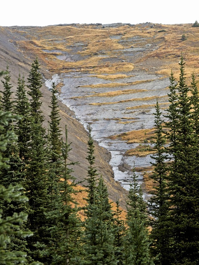
One short stretch of trail was sort of washed out, either due to a small avalanche or a small landslide during melt season. The worst of it was at the bottom of a small dip in the trail. And then we resumed the climb towards the pass.
Aylmer Pass
A full 5 hours and 14.5 km from the parking lot, we reached Aylmer Pass and approached the Banff National Park / Ghost River Wilderness Boundary. And a partial rainbow greeted us!

Over the next 30 minutes we did our best to absorb the otherworldly feeling of this remote mountain pass. Between bites of sandwich we studied the surrounding peaks, folded layers of rock and vegetation (including one tiny larch). Carefully wiping raindrops from our camera lenses between shots, we did our best to capture a sense of the place.


This is also when we started wondering how we could get at least partway down into the next valley without having to camp overnight.

Knowing we had to hike another 15 km back to parking, we started back along the pass a few minutes after 1 pm. Over the next half hour, we stopped to take several more photographs of the unique geology and landscape.


By 1:45, we re-entered the forest and picked up the pace with the aim of reaching the parking lot before dark.
Return
Of course we stopped quite a few times, mostly to photograph details we’d ignored on the way up. For one thing, we spotted vibrant leaves.


We also noticed a wildlife camera that we’d missed on the way up. (Yes, Mr. GeoK smiled for the camera 😉 .)

And it was a funny coincidence that within a few minutes of spotting the wildlife camera, we spotted more wildlife – this time a spruce grouse, just off the trail.


Something like 30 minutes or so from the Lake Minnewanka Trail junction, we heard the first other humans we’d heard all day! It turned out to be three runners that we think turned around at the Aylmer Lookout fork. Shortly after we stepped off the trail to let them pass, we spotted the lovely aspen trees that meant we were just about back at the Lake Minnewanka Trail.

We reached the trail junction at 3:15. Since we’d made such good time, I had the “bright” idea of checking out the Lm8 Aylmer Pass backcountry campground. It’s located just up from the lakeshore, across from Mount Inglismaldie. Strong winds and the large lake combined to produce rolling waves, including whitecaps.

The campsite is in a lovely grove of aspen trees – a beautiful spot for a night or two of fall camping.

By the time we made our way back to Lake Minnewanka Trail, my “bright” idea added another 750 meters and 15 minutes to our total hiking time. That doesn’t seem like much as I sit typing this trip report, but by the time we got back to the parking lot, we felt everyone of those minutes/meters!

For the next two hours/8.2 km it was a matter of putting one foot in front of the other. We made way for the trail runners returning from the Lookout Trail. And another time we stepped to the side so a group of four mountain bike riders could go past towards the end of the lake.
We also stopped to enjoy the lovely late afternoon light.

By the time we reached the Stewart Canyon bridge, we were tired and just wanted the hike to be over.

Shortly after 5 pm, the back of the trailhead sign came into view. We stopped and took a closer look. There’s no doubt about it – our GPS tracked a lot more distance than the posted 26.6 km round trip distance.

We muttered back and forth about the discrepancy as we covered the remaining 600 meters to where we’d parked. But we made it back before dark! And we look forward to going even further another day!
SUMMARY
Aylmer Pass is on our list of hikes to do again. We’d like to explore a little further in Aylmer Pass. And we’d like to take the side trail to Aylmer Lookout. That might require yet another trip. We would definitely wait until fall, for two reasons. First, we’d want to bike the Lake Minnewanka Trail portion, so that means before July 10th or after September 15th. Second, the fall colours were spectacular, and really increase the scenic value of this hike.
Distance = 32.5 km
Elevation gain = 1372 meters (803 net)
Hiking time = 8 hours 15 minutes plus 1 hour 45 minutes for lunch, photography/videography and rest stops (total 10 hrs)