
NOTE: As of September 2021, Three Sisters Mountain Village is exercising private property rights and has posted NO TRESPASSING signs at the access point to East End of Highline Trail. It’s an evolving situation, covered by CBC News on September 4th. We hope that Alberta Parks and Three Sisters Mountain Village soon reach agreement on access to the Highline Trail. Stay tuned…
One of Canmore’s beloved single-track mountain biking routes, the Highline Trail also works as an easy conditioning hike – especially over the winter season. With four points of access, it’s possible to 1) hike a loop that incorporates a portion of Highline Trail, 2) opt for an out-and-back route, or 3) hike one way and use Roam bus transit to get back to your starting point.
Route/Distance Options

Options include:
- Loop – East connector to Highline Trail to West connector to Powerline Trail, approximately 7.2 km. This is a good option if you’re staying at Worldmark’s Grand Canadian Resort, one of several B&Bs in the Carey/Homesteads neighbourhood, bunking with friends/family in Peaks of Grassi or ride Roam transit to Walker East/West. Add another .5 km at the start and finish if accessing from Quarry Lake Park (Roam bus stop, weekends only). Add 2.3 km by opting for Riders of Rohan connector instead of West connector.
- Out and back – Three Sisters connector to the top of Riders of Rohan connector and back, approximately 12.6 km return. Street parking is available along Hubman Landing. The nearest Roam bus stops at time of writing are Dyrgas Gate/Three Sisters Parkway at Dyrgas, adding another 2 km or so to walk to/from the Three Sisters connector trailhead.
- Out and back with loop – Add elevation gain by starting from Three Sisters connector, hiking to West connector, dropping down to the Powerline Trail, hiking up East connector and then back to Three Sisters, approximately 11.8 km.
- Consult your favourite map resource to plan your own route incorporating all or a portion of Highline Trail. Keep in mind that Highline Trail is in a wildlife corridor and should be accessed only via official connectors: Three Sisters, West, East and Riders of Rohan. There are many other unofficial trails in the area; starting in 2018 Alberta Parks and local wildlife groups turned up the messaging sticking to official trails in wildlife corridors.
Trail Description
I hiked portions of the Highline Trail a few times this winter, generally starting from the Three Sisters connector which is accessed by passing through a bike/pedestrian friendly opening in the locked gate that prevents vehicular access. There are clear indications early on that the Highline Trail is used predominantly by mountain/fat bikers – namely the slightly banked corners and small ramp a few hundred paces from the trail head. This is also where I spotted one of the many squirrels likely to chitter away at trail users!

In 2018, Alberta Parks installed signs explaining that the Highline Trail is inside a wildlife corridor and that users are to stick to designated trails. One of these signs is posted about 3 minutes from the trailhead.

The trail is easy to follow – it’s well established and blue plastic trail markers make it clear which branch to follow at trail intersections (many of which are unauthorized trails that Alberta Parks may reclaim over the coming years). Keep an eye out for sections of old wooden pipe beside the trail. This pipe was used to transport water from Three Sisters Creek during Canmore’s early coal-mining days.

Many sections of the pipe were broken down/scavenged for wood to re-build creek crossing following floods in 2011 and 2013. There are currently 2 bridges in place that are decked with scavenged wood. One crosses a shallow gully and the other bridges Three Sisters Creek.

Depending on time of day, your desire to watch mountain/fat bikers cross the bridge, whether there’s a clear view of the peaks of Three Sisters and/or whether you need a snack/rest break, there’s a rustic picnic table just across the bridge on the west back of Three Sisters creek.

From the bridge, there’s a very short, steep incline followed by a sharp right then almost immediately sharp left. If, you’re not starting to climbing within 3 to 4 minutes of leaving the picnic table, you’ve probably missed the turn. You’ll know you’re on the right track if you see a log lean-to just off the trail.

There’s a varied soundscape while hiking Highline Trail through the woods in the winter: squeaking snow underfoot, chattering squirrels and grey jays, the occasional beating of helicopter blades, cawing crows, whining chainsaws, percussive rumbling of trains making their way through the town site and – of course – your own (occasionally heavy) breathing!

It’s also easy to see why this is a popular biking trail, thanks to banked corners, switch backs and occasional peek-a-boo views. It requires more skill than I have to ride. And more nerve – long stretches of track are bounded by a steep drop-off on the downhill side and a vertical rock wall on the uphill side! Pedal scrapes on some of the rocks indicate heavy use.

The trail also has a decent flat stretch, an icy section, another wooden bridge, access closed signs and a very bent over tree before reaching the intersection with the East Connector.


NOTE: I accessed Highline Trail using the East Connector once during the winter hiking season. While the intersection of East Connector and Powerline Trail is clearly marked and there’s good signage at the east end of the Peaks of Grassi neighbourhood, I ended up going off track on one of the many undesignated trails in the area and had to retrace my steps before ending up on the less well-established East Connector. It’ll be interesting to see how much enforcement/trail reclamation Alberta Parks does in this area over the coming years.

Between the East and West Connector intersections, Highline Trail flirts twice with a wide draw, winding up and back and around until finally crossing the draw with a view into and across valley. The supposedly flood-hardened Cougar Creek channel is visible on the far side of the Bow Valley.


There are two more, smaller draws with peek-a-boo views, and then shortly after turning on to West Connector there’s a sign warning of the steep descent to come…

Indeed, the relatively steep grade offered a significant gravity assist – I was pretty much running along, even though I’m not a trail runner. This woods surrounding West Connector are quite different to those along the Three Sisters and East Connectors. I enjoyed the play of light and shadow on the the tree trunks and stopped to enjoy a large stand of birch/aspen!!


Yet more signage styles at the West Connector indicate that Highline Trail has evolved and stretched over the years, mostly because of direct support from the community (including some key, long-standing volunteers).


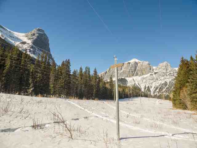
At the bottom of West Connector, I turned east along Powerline trail, with East End of Rundle (EEOR) at my back and Pigeon Mountain visible in the distance ahead. A ski pole sign indicates the trail to Quarry Lake.
In the course of three weekend morning outings over the winter months, I encountered just 8 other people on Highline Trail. Most were trail runners, three had leashed dogs with them, and two on bikes. Highline Trail is much busier during non-winter months, and no matter what time of year it’s important to keep a sharp ear out for overtaking or approaching riders and stay alert for signs of wildlife (bears and cougars have been seen in this area, so remember to carry bear spray).
As of May 18, 2019, the town council of Canmore has Roam Transit Canmore local route 5 free for the remainder of 2019 – a great option for anyone wanting to try a one-way exploration of Highline Trail.
Summary
Highline Trail is a hard-packed trail with multiple route options. Well-used by fat-bike riders, mountain bikers and trail runners, it’s also a an easy-to-reach conditioning trail well-suited for winter hiking. Mostly in the woods, there are a few peek-a-boo views into the Bow Valley, including the flood-hardened Cougar Creek.
Total distance – varies, up to 12.6 km
Elevation gain – up to 455 meters, depending on route
Hiking time – up to 2+ hours, depending on route